
You are here: Home > Products and Services > Data Solutions
Have any Questions?
Data solutions
GIS and Imaging
We use Geographic Information Systems (GIS) and other imaging techniques to obtain visual representations of scientific data for water bodies. We use it for our system-scale modelling work. It enables us to build a clear picture of an aquatic system.
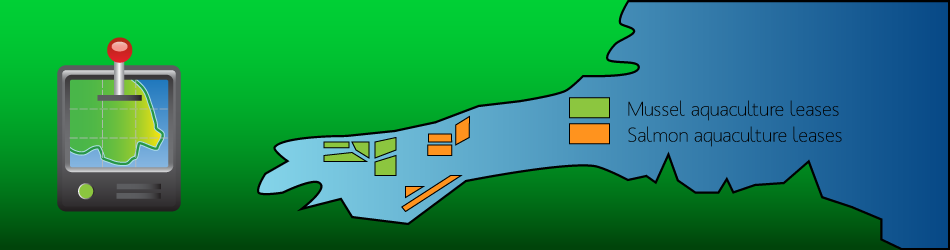
GIS allow us to build visual representations of coastal water uses, including aquaculture, fisheries, tourism, shipping routes and other competing uses. We incorporate GIS, remote sensing and bathymetry into our system-scale modelling, allowing regulators and stakeholders to make informed decisions. Our approach uses takes into account economic, environmental, social and economic components.
Water Databases
Water quality data is the backbone of our modelling. Depending on the modelling, we require data to drive your simulations. We have developed BarcaWin2000, which allows for thounsands of data points collected from different sampling stations to be stored, sorted and exported in order to model for aquaculture and fisheries problems.
BarcaWin2000 can be used for any water data collection or monitoring program, providing a host of efficiency savings. We find it essencial to collect the large volumes of data required to run our models.
Database Development
We provide be-spoke software applications and database development for the marine environment.
If you would like to know more about our data solutions or have any questions talk to us.
« back